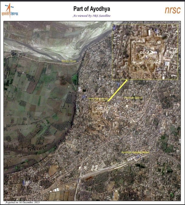
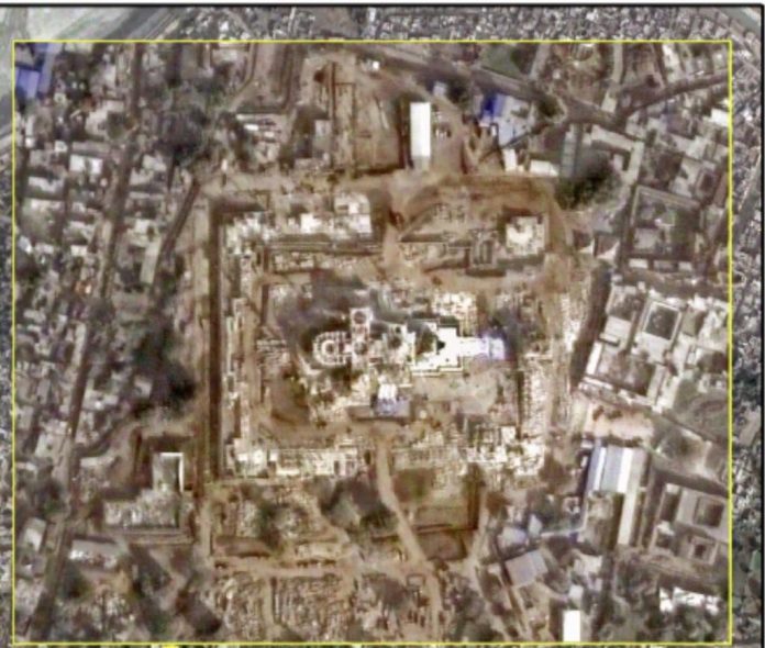
The Ram temple's imminent grand opening in Ayodhya has stirred anticipation and public excitement, reaching its zenith on Monday. In a captivating revelation, the Indian Space Research Organisation (ISRO) showcased an image of the Ram Mandir captured by the Indian Remote Sensing Cartosat satellite on December 16. Processed by the National Remote Sensing Centre (NRSC), this satellite imagery offers a detailed glimpse into the ongoing construction of the revered temple.
The 2.7-acre Ram Temple site is prominently featured, and an enlarged view further enhances the viewer's understanding of the construction progress. This snapshot, taken just a month ago on December 16, faces the challenge of dense fog over Ayodhya, hindering a clearer perspective since then.

The Cartosat series, known as India's eye from space, comprises Earth observation satellites crafted and operated by ISRO. These satellites play a pivotal role in various applications, including cartography, urban and rural planning, coastal land use regulation, and utility management such as road network monitoring and water distribution. They contribute to creating land use maps, facilitating change detection, and supporting Land Information System (LIS) and Geographical Information System (GIS) applications.
Scheduled for consecration on January 22, the Ayodhya landscape is adorned with decorative elements, murals, and paintings. Sun pillars, inscribed with ‘Jai Shree Ram,' have been erected, contributing to the vibrant preparations for this momentous event.
The temple has been built in the traditional Nagara style and has a length (east-west) of 380 feet, a width of 250 feet, and a height of 161 feet. Nagara architecture is a style of temple architecture that originated in North India.

The BuckStopper, run by a group of seasoned journalists, holds the powerful accountable. The buck stops with them, as they cannot shrug off their official responsibilities.


